The geographical centre of Canada is located on the northwest coast of Hudson Bay; this northernly location is caused by the extraordinary extension of the Northern Territories, the Arctic Archipelago reaching as far as 83° N at Cape Columbia, on Ellesmere Island.
The region around the geographical centre is scarcely populated, with four main settlements: Rankin Inlet, Chesterfield Inlet, Baker Lake and Arviat. All of them somehow related to the times of whale hunting and fur trading around the Bay.
The Kivalliq region of Nunavut, Canada.
The main settlements are along Thelon River, for centuries the most important way to access the area. It flows eastwards 904 km to discharge into Baker Lake and Chesterfield Inlet.
The Thelon River is one of the great rivers of the North.
For the Inuit, the river is a vital source of caribou and fish. Not only did they live near and around its course, but they also provided the waterway route to the North for many of the Europeans that travelled and traded in that area.
Thelon River's basin is designated Canadian Heritage ; a magnificent tundra scenery, a land of caribou herds, musk-ox, white wolves, gyrfalcons, grizzly and wolverine.
The Thelon sweeps across spruce-lined valleys, winding through the barrens and shimmering lakes, like mirrors in the tundra.
------------------
The other settlements are smaller but somehow all three related with the fur trade times:
Map of the HBC fur trade routes.
Chesterfield Inlet
Coordinates: 63°20′ N, 90°42′ W
Population: ~ 330
Chesterfield Inlet (Igluligaarjuk, meaning "a place with few igloos") is located east of the mouth of Thelon River, where the inlet merges into Hudson Bay.
This small hamlet is considered by some people the oldest continuing community in the eastern Arctic. Along the 17th century, brittish ships visited the place in search of the Northwest Passage, as by the time the inlet was thought a possible access.
In 1912 both Roman Catholic missionaries and the Hudson Bay Company opened here their permanent residences. And Rasmussen, the danish explorer, stayed here a few days in 1922 during the 5th Thule expedition.
The HBC outpost in Chesterfield Inlet.
The house is now part of the 'Northern Store' facility; on the wall, the old HBC times are reminded in a historic map.
A house of the HBC complex is now a private residence.
Until the 1950s, Chesterfield Inlet was of great importance in the eastern Arctic with its supply buildings for the HBC and a large Roman Catholic mission.
Built in 1944 as 'Hospital of St. Thérese', this Catholic Mission House is now a residence for disabled elders.
Chesterfield lights at dusk, reflecting on the Inlet waters.
Rankin Inlet
Coordinates: 62°48′ N, 92°05′ W
Population: ~2500
Rankin Inlet is the most important settlement in the Kivalliq region, a dynamic and growing town with modern facilities.
The arrival of American and European whalers in Hudson Bay in the 1800's marks the first years of Rankin Inlet. Later, the whalers departed, and the local Inuit population was only visited by missionaries and the HBC traders, who had been around since the 18th century.
Rankin is now a government town, a bustling community that serves also as a transportation hub for the Kivalliq Region, thanks to its modern and well equipped airport.
Rankin Inlet airport Terminal, always busy.
The arrival of civil servants and their families revitalized the community. Miners, farmers and artists made transition into government jobs.
The brand new Health Center.
The Arctic College of Rankin Inlet.
The 'Northern Inn' and its tower clock, a typical feature in town.
And one more.
Tara's B&B, shop and café
Shopping with style, Rankin way.
I really enjoy this !
Sealskin 'Mukluks' during a community celebration.
Come on, brave little school bus !
Arviat
Coordinates: 61°06′ N, 94°03′ W
Population ~1800
Arviat is a traditional Inuit hamlet located on the western coast of Hudson Bay, the southernmost mainland community of Nunavut. Arviat is situated 90 kilometres north of the tree line. Tundra lands, lakes, rivers and seawaters are rich in wildlife, as the thundering herds of migrating caribou.
When the Hudson Bay Company set up a trading post here in 1921, they called it 'Eskimo Point'. The HBC post attracted Inuit to the area, as arctic fox were plentiful and trapping was a profitable trade. Catholic and Anglican missions arrived in 1924 and 1926.
Modern housing.
The village's name was changed to Arviat in 1989.
The two churches.
The 'Donald Suluk Library', a resource for students in the community.
'Inns North', the best accomodation in town.
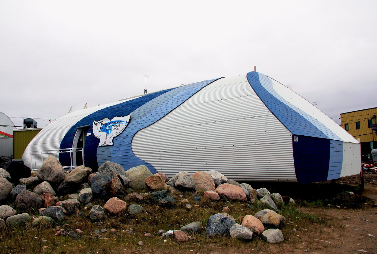
The surprising Visitor Center to the Kivalliq region.
-----------------------------
An elaborate woven wall hanging by native artist Isaqkijaq, decorating Nanuk Lodge in Rankin Inlet.


.jpg)


0 comments:
Post a Comment