
The Igloolik island and settlement are among the most visited in last century's arctic expeditions, by land or by sea.
Igloolik is located right on a possible Northwest Passage, almost half way from Greenland to Alaska, in a sea strait often frozen, making it a strategic place for the wintering and refurnishing of ship expeditions.

The route from the Atlantic ocean through Foxe Basin to the Gulf of Boothia is part of the historic Nortwest Passage expeditions. William E. Parry, in his 'Second voyage for the discovery of a north-west passage', during the years 1821 to 1823, mapped the east coast of Melville peninsula.

The narrow strait connecting the Foxe Basin westword to the gulf of Boothia was named the Fury and Hecla strait, in hommage to Parry's two ships. Later, in 1847, John Rae proved Melville is a peninsula, not an island.
By the end of the 1930's the Hudson's Bay Company had set up a post on the island. But only in the 1970's was the hamlet officially recognized and benefited from minimum facilities - nursing station, health care, basic education and decent housing.

Igloolik is quite close to the large Melville Peninsula and its other settlement of Hall Beach, a few hours distance to the south.
Population: ~ 1600
Coordinates: 69°22′ N, 81°47’ W
(North of the arctic circle)

The name 'Igloolik' means 'there's a house here'. It derives from igloo, which means house or building.


Igloolik's local radio station.

The 'Nunavut Quest' – a top dog sled race through High Arctic.
The sled race runs hundreds of miles from Igloolik to Pond Inlet, or from Arctic Bay to Igloolik - it's not always the same route. The first race was called the North Baffin Quest, with competing mushers from Clyde River, Igloolik, Arctic Bay, Pond Inlet and Hall Beach.

Local women in traditional clothes.

Inuit children.

Modern Igloolik
The airport terminal:

An important link to all southern Canada.
The Tummivut building:

Housing the local government's offices.
The 'Igloolik Research center':

Artist Henry Evaluardjuk (b.1923) was born in Igloolik. His beautifully stylized bears are likely the result of his hunter’s memory combined with the influence of varied native communities he visited.


Hall Beach
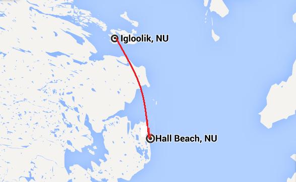
Hall Beach (Sanirajak) is just 70 km south of Igloolik, at the north-eastern tip of Melville peninsula.


Coordinates: 68°45′ N, 81°13′ W
Population: 650 -700

.JPG)
Hall Beach is the oldest permanently populated community north of the Arctic Circle. Nearby there are a few Thule archaeological sites.


The DEW line
The community of Hall Beach was formally recognized as a hamlet in 1957, following the construction of a DEW (Distant Early Warning) station here.

This was a system of radar stations in the far northern Arctic region of Canada, Aleutian Islands of Alaska, the Faröe Islands, Greenland and Iceland.

It was set up to detect incoming Soviet bombers during the Cold War, and provide early warning of a land based invasion.

The military base attracted people to this area with the promise of jobs and trade.
After the Cold War ended, the DEW station was eventually decommissioned.
The flora of Melville peninsula
I'd like to end with some more joyful subject. Maybe with some images of the local flora - the arctic tundra explodes in colourful clusters of flower each spring. Here are some examples:
Arctic Lousewort

Moss Campion

Purple Saxifrage

Arctic Bell Heather
.jpg)
Mountain Avens

