Friday, 24 March 2017

Whitehall, Stronsay (Orkneys) - a gloomy feeling of far North, plus an impressive natural arch.


At over 59º N, this is almost sub-arctic Scotland, in a small island northeast of Orkney Mainland. Whitehall is two hours away by ferry from Kirkwall, the most populated and nearest town with urban and social services.


Whitehall is a small village with about 50 houses. It has a fishing harbour and ferry pier, post office, hotel, pub and B&B, shop, café and heritage centre, a chapel. And a small bank branch rarely open.


In the Orkneys, Stronsay is known as the 'star island' for its shape. Bays, coves and cliffs carve the low coastline (max. 44 m). A larger map is displayed at the end of this post.

The village between two piers: left, the ferry pier (east); right, the fisherman pier (west).

Whitehall, Stronsay Island, Orkneys

Coordinates:  59° 8′ N, 2° 36′ W
                     (as Uppsala, Norway)
Population:  ~ 370

The west tip of Whitehall.

The village spreads along its main and only street, between the arms of its two piers. Most of its properties are hints of considerable past wealth.


Aligned in a curved bay waterfront, houses look like fancy dwellings dating from the days when the vast herring fleet came in, from the 17th century until the 1930s.

The 'white house' and, at right, the RBS little agency.

Central Whitehall


Whitehall takes its name from a (white) house built in the 1670s that has been demolished.

The best view is probably this row of houses reflected on calm waters.

Until the 2nd World War, Whitehall had been the biggest herring port in the northern Orkney Islands, trading mainly with the Baltic ports of Russia and Eastern Europe. This wealth brought a larger population and was evident in some of the houses.


These fine gabled houses witness the wealth earned from the fisheries.


Some of Whitehall houses:


The Post Office


The only colourful house in Whitehall.


White house in Whitehall. Not the original, though.

A few houses have glassed sunrooms like this to enjoy the sea view in sunny days.


The best building in town - the Stronsay Hotel, restored and refurbished.


Corner at the cosy Hotel bar


Music at the bar.

One only shop:

Ebenezer Stores


Soap from Stronsay's 'Craftship Enterprise'.


Oh that ? it's the Royal Bank of Scotland !


Not many customers, so, one only opening day!


As for reading the news:

The Stronsay Limpet is the local monthly newsletter.

A village between two piers.


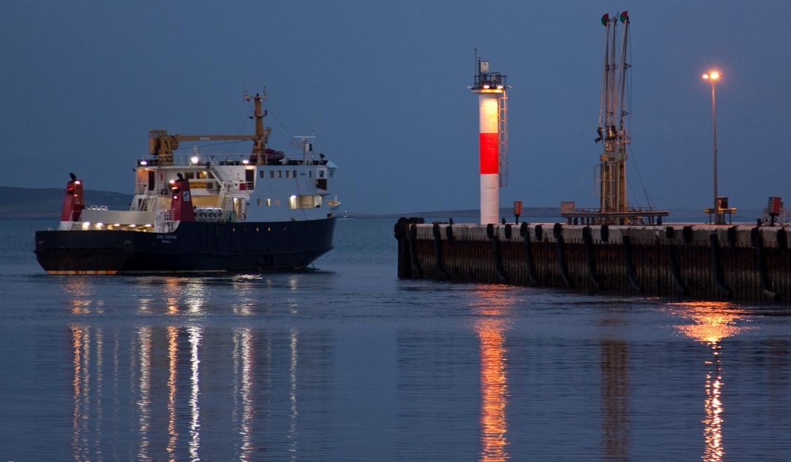
Whitehall harbour is the terminus for the ferry service from Kirkwall.


The Harbour Office

The first building as you leave the pier is the Fish Mart, a long house which once was the local market and now is a hostel and café.


Offering teas, coffees, homemade cakes, light lunches and accommodation.

Delicacies from the café.

The two piers enclose a herring fishing history.

The fishermen's pier, west of Whitehall.

Whitehall historical growth and decline is closely linked to the herring industry, which was initially developed by the Dutch.


At its height, 300 boats were moored in the harbour, along with fifteen curing stations. The fleet followed the herring shoals down the coast. By 1939 the herring had moved elsewhere and the start of the Second World War brought the trade to an end.


It is difficult to imagine Whitehall as it would have looked each July and August during the height of the herring boom from the 1880s. For some six weeks the population of Stronsay, normally around 1200 at the time, would rise to over 5000 as fishing fleets, fish gutters and others descended on what at the time was by far Orkney's most important fishing port. Not less than forty pubs worked here in the high season, and many houses took lodgers.


Stronsay Inland 

There is a smaller living centre in the island, between St Catherine's Bay and the Vat of Kilbister. The Junior High School, with a public gym and swimming pool; an old chapel has been converted to shelter the iconic Craftship Enterprise, housing Airy Fairy and others.

At Stronsay Junior School.

The old chapel (Mallettt),
now the Craftship Enterprise

This chapel now named Mallett was  built in 1800 during one of the schisms in the Scottish church.


Presently the Craftship Enterprise hosts there workshops and holidays, producing unique greeting cards and handmade wedding and home decorations. Quality quilts, children’s clothes and fabrics from Airy Fairy are widely appreciated.

A ‘Crafteria’ is also available for lunches, homebakes, teas, coffees and cakes.
Some examples:


The Moncur memorial Church


Stronsay's only church lies by the centre of the island on the B9060 road. It was built between 1950 and 1955.

A very sober interior, the design emphasises simplicity.

Stronsay, the "star Island".

Stronsay was named by one seafaring people (the Vikings) and then settled by another (the Dutch), so its people always had close links with the sea. For such a small area (33 km2), the coast length is amazing - over 35 km - , due to its indented star-shaped form.


The name Stronsay comes from the Norse Strjónsey meaning "Star Island" ; it is also one of the most fertile of the Orkney Islands, even though it's treeless by nature.

Holland Farm at Tor Ness, Stronsay

A tree in Stronsay ! or at least kind of...

The island is relatively flat and the highest point is Burgh Hill at 46 metres.

The coast of Stronsay - rocks, cliffs and sandy bays


The old Mill (now disused) at Mill Bay.

St Catherine’s Bay, the Bay of Holland, the Bay of Huip and Mill Bay have the largest expanses of sand, but there are many other small beaches to explore, with all choices of sun and wind direction.

 Mill Bay sands.


Rothiesholm sands.

Maybe the best sany beach in Stronsay.

Sunset at Rothiesholm.


The Vat of Kirbuster, a giant natural stone arch in the rocks


This arch on the southeastern coast is 10.6 m long and 20m above the sea. It was created bu the collapse of a cave in the cliffs.


Nearby, the remains of a broch - once an iron-age defensive tower with rooms within the double walls. Stronsay has a number of archaeological sites, like brochs and cairns. A large chambered cairn near the Bu and two smaller ones at Lamb Head.


These two flint arrow heads from the Mesolithic Period found in 2007 at Links House, Stronsay, are believed to date back to between 10 000 and 12 000 years ago.

Several caves are visible in Burgh Head and Lamb´s Head

Sea stack and high cliff at Burgh's Head. Nearby Burgh Hill, at 46 m, is the island's highest point.


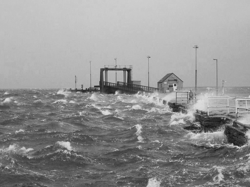
Whitehall Under Storm


Sea storms are the most feared threat to Whitehall. People are usually prepared, nevertheless the damage is often heavy.


Things seem to get worse in recent years.

The Hotel is somehow protected by the further waterfrontly Fish Mart.


There is a landing strip on Stronsay for small planes, but it is by ferry that people in Stromsay have most contacts with the outside world.



Some links:

Craftship Enterprise:
​http://www.craftshipenterprise.co.uk

Stronsay Fishmart Cafe & Hostel
​http://www.stronsayfishmart.uk

Airy Fairy
http://www.airyfairyonline.co.uk

Stronsay Limpet
http://www.stronsaylimpet.co.uk

Orkney Star Island Soap & Textiles
http://www.orkneystarislandsoap.co.uk

Storehouse B&B.
http://www.storehousestronsay.co.uk


Yes !


Thursday, 9 March 2017

Tjøtta, Alstahaug - medieval church and scenic mountains by the Artic Circle in Norway.


Alstahaug is a municipality in Nordland county, Norway, rich in nature wonders and historical sites.

The coast at Altahaug: a multitude of small islands facing the 'Seven Sisters' mountain range.


The most interesting village is Tjøtta, on a small island at the tip of a narrow peninsula by the norwegian coast, and few kilometers south of the Arctic Circle. So, as you may already know, this is a quite possible area for the ancient Greek sailor Pytheas to have landed and later named "Ultima Thule".

The nearest main towns are Mo i Rana (see here) and Mosjøen.


Tjøtta

Coordinates: 65 ° 50' N, 12 ° 25' E
Population:  ~ 250

The old trading center by the quay.

Two historic sites here atract visitors: the old Farm and the stone church.


The main house of Tjøtta Farm is now a guesthouse. Between 1767 and 1929, the farm was family ownership, but after 1930 it became State property.


Tjøtta Låna

A "lån" is a long and narrow dwelling house. Låna is a two-storied building, erected from cogging jointed timber and clad with vertical red painted panelling. It is believed that the house was built around 1800 or maybe earlier.

Tjøtta church


The church was built on the outskirts of Tjøtta farm. The original church was probably built around 1000, when the reigning Viking chieftain Hårek Tjøtta were baptized at the farm in the year 999. The present day church was erected in 1851 in natural stone, designed as a long church with seating for 310.


Neo-gothic elements like the high windows decorate the walls.


Alstahaug, Alsten Island
(see map below)


Alstahaug village is famous for the Petter Dass Museum, installed on the previous vicariate house, and the onion dome church.


Alstahaug yard includes the museum and the church

Coordinates: 65° 57′ N 12° 34′E
         (just 60 km below the Arctic Circle)
Population (municipality) :   ~ 7300


The old parsonage

The Parsonage at Alstahaug dates back to the first half of the 18th century, and has well-preserved interiors from the 18th and 19th centuries. Petter Dass was a parish priest from 1689 and until his death.


The rooms are unchanged from what they were centuries ago.


Alstahaug medieval church


As part of the Petter Dass Museum, the precious Russian-inspired church sits in Alstahaug yard, on the southern tip of the island Alsten.


One of few surviving medieval churches in northern Norway, the stone church was built in the 1100 -1200s, in local quarried soapstone. It is Romanesque with a rectangular nave and narrow square choir.


This region was dominated by Viking chieftains opposed to the christianization of Norway lead by king Olav II; so this is probably one of the first churches ever built in Alstahaug.


The onion dome and the roof.

The church is built in Romanesque style with typical round arches and thick walls. The south portal, which is situated on the choir left side, is considered to be one of the loveliest from the Romanesque period in Norwegian architecture. It has a base with an Attican profile, which rests on an embedded column with spherical-shaped capitals. The arch's abutment stones and the actual arch are decorated with carved “sunken stars” and the columns have the Attic base profile. These stars are not known used after 1200, making dating of the church easier. 

The side porch is tooped with an arch with star decoration, which is typical of 1200 romanesque.

It is uncertain what the weekend church has been devoted to, but there is reason to believe it has been devoted to St. Olav.

The beautiful choir and organ.


-------------------
When passing through Alstahaug waters, the Hurtigruten coastal express must sail under the elegant bridge over the Leirfjorden, at 66º 02' N.

The 1065 metre long Helgeland Bridge connects Alstahaug to the mainland.


Alsten Island and The Seven Sisters (De syv søstre)


The majestic 'Seven Sisters' in Alsten are a mountain range to take anyone's breath away. The seven peaks are a rock formation on the southeast of the island.


Thrusting their heads above the shoreline, they form a dramatic backdrop to the myriad of islands and the lush landscape.


Skjæringen, at 1,037 metres, is the highest peak. The escalation is even rather easy, access has been improved.


Their beauty may be admired from the cycling path or from the deck of the Hurtigruten express ship.


Hurtigruten offers a memorable experience. The ships arrive at Alstahaug every day, and they go slowly and close enough for the joy of its passengers.