Preserved by time, it's really like travelling backwards one or two centuries.
Probably few people ever heard of it, that's why it figures here in Ultima Thule. Besides, this is a little jewel.

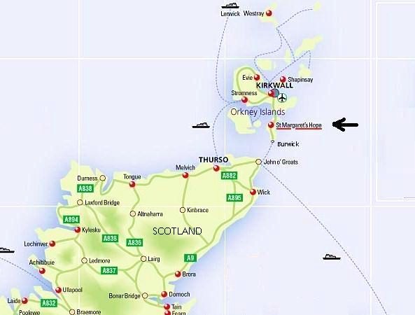
The village of St. Margaret's Hope, known locally as The Hope ( [Hup] ), lies on the causeway-linked isle of South Ronaldsay. It is Orkney's third-largest settlement, named probably after St. Margaret, wife of King Malcolm III of Scotland. By that time, Norway lost the rule of the islands to the Scottish Kingdom.
As you approach the coastline by ferry, you notice a set of dark gabled houses, one or two white painted, and a church, up on a descending road.

The word Hope comes from the Norse word 'hjop', which means bay. The safe bay was used as a Viking anchorage in the 13th century, and continued drewing more trade in later centuries.

Coordinates: 58.8° N, 2.9° W
Population: ~ 560

By the 18th century there were 50 fishing boats working from the harbour, where a fishing station was later established, and the village grew, like so many in Orkney and the east coast of Scotland. By 1842 there were 245 herring boats in The Hope.

The fishing character becomes clear with all those sandstone piers and jetties into the water of Hope bay.
The village has one main street - Front Road - where almost everything is located.

St Margaret’s Hope is an old fashioned village with a winding main street which, at two points, descends down a steep hill. The waterfront is attractive, and there’s a square in the center.
In town, there is an art gallery and craft shop, hotels, inns and B&B, shops, a post office, a café and an award-winning restaurant, a golf course and the Hourston Smiddy Museum with artefacts used by blacksmiths.

Let's start on Front Road:


The most famous restaurant around.


Shops - just a few!


http://www.workshopandloftgallery.co.uk/

The Blacksmith's museum, known as the Smiddy:

In the town center, the Cromarty Hall is the place to be for cultural events, like films and drama:

http://www.thecromartyhall.com/
Church of Scotland

Opened 1856, the church was designated as the principal place of worship for the Parish of South Ronaldsay and Burray.
St. Margaret's Hope is connected by ferry to Scottish mainland.

Pentland Ferries runs daily catamaran ferry service between St. Margaret's Hope and Gills Bay, near John o' Groats. The journey takes about one hour.

------------------------------------------
Around St. Margaret's Hope
 On the island of South Ronaldsay, and then going north to the small island of Lamb Holm, there are some other features not to miss:
The Millennium Stone

This large stone, thought to be an old standing stone, lay undisturbed in a ditch near St Peter's church for at least 30 years. Three local men decided to move and re-erect the stone as their own Millennium project.Around St. Margaret's Hope

The Millennium Stone

The Churchill Barriers
Man-made barriers were ordered by Winston Churchill as naval defences, to protect Scapa Flow from submarine attacks, following the torpedoing of the HMS Royal Oak in 1939.

Since 1940, they linked South Ronaldsay to the isle of Burray, than Glimsholm and Lamb Holm right through to Mainland Orkney, creating an overland road connection.

There are several of these barriers, over which runs the only road from The Hope to Kirkwall and Stromness.
The Italian Chapel
One of these islands is the small Lamb Holm island, where a magnificent chapel surges from nowhere just like that - on the corner of a barren grassy islet...

Made from two converted Nissen Huts, during WWII by Italian POWs in need of some homely comfort.


------------------------------------------
Though not a remote arctic location, St. Margaret's Hope is a hidden treasure deserving a mention here as one's possible Thule.


