Tuesday, 23 October 2012

Qikiqtarjuaq, Broughton Island, door to the Auyuittuq Park


Qikiqtarjuaq (meaning big island ) is located just north of the Arctic Circle and off the east coast of Baffin Island, in smaller Broughton Island (only 12 by 16 km).


A narrow strait of 3,5 Km separates the two islands, and at east Greenland is close by across Davis Strait.

The village is set in a glorious arctic scenery, in a large bay surrounded by mountains that in sunny days reflect on the quiet waters.


Population: ~520
Latitude 67° 33’ NLongitude 64° 01’ W


One of the more traditional communities in Nunavut, Qikiqtarjuaq is known for its traditional Inuit and modern clothing, including sealskin parkas and kamiit (skin boots).


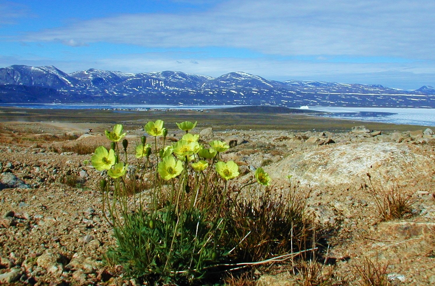
Abundant wildlife and beautiful scenery attract visitors to Qikiqtarjuaq, often called ‘Qik’ for short.

In the 1800s, European whalers would crisscross the Davis Strait between Greenland and Baffin Island to trade goods with the local Inuit people.


Qikiqtarjuaq is also the ‘Iceberg and Diving Capital of Nunavut’. The community has several local certified divers available throughout the diving season.

A nine-room inn, the Tulugak Hotel


Sunset at Qikitarjuaq bay

More infos : here and here
 
Broughton Island


Some views :


Aerial view

The east coast,looking to Greenland across Davis strait

Cape Broughton also looking east

In spring landscape is decorated with artic flowering like these poppies.

AUYUITTUQ PARK

Qikiqtarjuaq is conveniently close to the northern boundary of the majestically mountainous Auyuittuq National Park in Baffin Island, a closer door to the park than the southern hamlet of  Pangnirtung.

Coordinates 66°32′N, 65°19′W

Auyuittuq National Park has amazing glaciers, waterfalls, sheer cliffs, semicircular valleys, flat-topped peaks like Mount Asgard or steep peaks like  Mount Thor:

Mount Asgard

Mount Thor, a famous steep cliff 1675 m high

Auyuittuq’ in Inuktitut language means ‘land that never melts.’ Established in 1976, this national park protects 19 089 square kilometres of pristine, glacier-scoured arctic terrain. The Inuit people have used this majestic land for thousands of years as a traditional travel corridor.


Auyuittuq Park deserves by itself a dedicated post here, I will publish it as soon as possible.

Saturday, 13 October 2012

The Smoking Cliffs of Franklin Bay, just south of the Horton river mouth

In a recent post, I published an illustration of the Smoking Hills of Franklin Bay  as seen by british Captain Robert McClure in 1850, when he was exploring the coastline in search of the lost John Franklin expedition:


At the mouth of the river Horton, McClure sent a search party to investigate what appeared to be fire in what is now Franklin Bay. Thick columns of smoke were emerging from vents in the ground. The sailors returned with a sample of the smoldering rock, and when they set it down on McClure's desk it burned a hole in the wood.


Those Smoking Hills are located about 1 km south of the Beaufort Sea, a couple of miles south of where the Horton River brokes through the headland.


The odd rarity is easy to explain - deposits of lignite, carbon-rich shale, and pyrite rich in sulphur,  ignite spontaneously when the hills erode and the mineral veins are exposed to the air, producing a constant smoke.  


The Smoking Hills are very impressive. They are a long (60 km) stretch of cliffs and hills.


Franklin Bay ( 69°40′N, 125°30′ W ) is a large inlet in the Northwest Territories, Canada.


It is a southern arm of the Amundsen Gulf, on Beaufort Sea. Franklin Bay receives the Horton River, after meandering through the Smoking Hills on the east coast of Cape Bathurst. The river snakes sharply back and forth, creating a curved line parallel to the coast.


RIVER HORTON


The Horton starts from a small lake, goes through a wild canyon, then passes meandering at the back of the Smoking Hills and reaches the sea on the east side of Cape Bathurst, at Franklin Bay. There the Horton's mouth forms a  wide delta.

As the river approaches its mouth, it starts meandering through the tundra flatland.


The mouth is presently a delta in the east coast, into Franklin Bay; but some years ago the river's course was different.


The mouth was then 100 kilometres  further north on the west side of Cape Bathurst, until about 1800, when a meander eroded through.


This NASA satellite image shows the deactivated meanders, now filled with sea water, as the Horton suddenly carved his new mouth to the east. It's a rare anomaly of its kind.

Wednesday, 3 October 2012

Siorapaluk, the northermost community in the planet


Siorapaluk is an inuit settlement located in northern Greenland, on the west coast by Robertson Fiord, only 1362 km from the North Pole.

Qaanaaq, the area's main village, is less than 100 km to the south.


Siorapaluk is also the world's northernmost inhabited settlement (*)

Coordinates:  77° 47′ N, 70° 38′ W
Population:  ~ 70.


Siorapaluk reflects on the calm sea waters that bath its sandy beach


Siorapaluk means "little Sands", after the small sandy beach in front of the village. 

 Sand and ice

The settlement is as far as you can go north in Greenland and still have electricity, toilets and a shop. And TV, and internet.
Somehow, the last outpost of civilization...

Houses are generally well maintained and painted red, with a few in yellow or blue.

 Typical village house

 The local shop and post office


The church at Siorapaluk, with the side tower bell.

 The new school

View from school downwards to the sea in a sunny day

Many of the inhabitants are direct descendants of the last migration of Inuit from Canada in the past century. The main source for living comes from nature - there is good hunting and fishng in the area: birds, foxes and hares, seals and walruses.

The sledding craft is a daily job in this part of the world.

Trips by dog sled out into Robertson Fiord are a small extra income from summer tourists.


Returning home


Average temperature varies from the - 20ºC in winter to a few degrees above zero in summer (with records of -60, + 18ºC). High summer days have 24h daylight, but even that is usually not enough to get warm.

In recent years, though, the climate is less regular, there has been changes in ice thickness and higher temperatures.


Tall sandstone mountains surround the village, in tones of red and purple, ending at the sea in a narrow sand track. Farther, a glacier is visible in the bottom of the small Robertson fiord.


Long shadows as the only means of transport - dog sled - slides to the low sun:


(*) as a native community