Brønnøysund, a coastal town in the center of Norway, could well be the site of
Pytheas' mythical
Thule. The greek sailor might have reached this coast and taken it for an island, as in those times ice was all around and the sea frozen. And central Norway is not short of legends, though I'm talking of Nordic tales now.
Brønnøysund is a “
coastal town in the middle of Norway." In fact it’s located at the mid-point on the Norwegian coast on an elongated, narrow and twisting peninsula with bays and inlets, protected from the open sea by numerous islands, islets and rocks, which form large and small inlets.
Population ~ 5000
Coordinates: 65°28′ N, 12°12′ E
Brønnøysundbrua
The Brønnyøsund
curved bridge connects the small island of
Torget (where the
Torghatten rock is located) with the mainland. The ships pass under the left
side of the main span.
Maybe the best known building in Brønnøysund: the "Telegrafen" originally housed the telegraph office.
Tårnskolen, the old school.
Seahouse restaurant & bar
This is a prosperous region, with a well-run economy based on seafood, modern agriculture, wood-processing and tourism.
Whale sculpture at the harbour, called Steinar Breiflabb - a small islet turned into a stone whale.
'
Hurtigruten' coastal cruise calls twice daily at Brønnøysund.
Frøkenosen,
a sea-water filled lake, is also a quiet neighborhood
Brønnøy Church
Brønnøy Church is a 1870 stone church located just south of the city centre.
In the neo-Gothic style, the church is built in natural stone and wood.
Choir wall and the entrance have a core from the middle ages (12th cent.).
In 2008 the Church opened for use after ten years of restoration.
The old Claus Jensen organ from 1879 in the North wall.
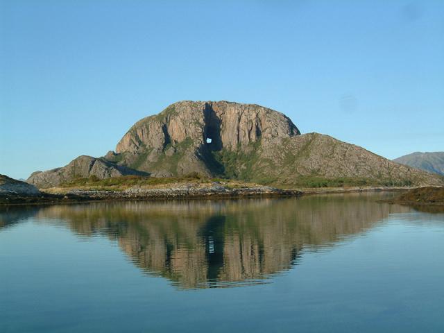
Torghatten, The Gates of Thor
During the Viking era,
Torgar, by the foot of the legendary mountain Torghatten, was a nationally powerful chieftain seat and an important commercial center along the coast.
The Torghatten (*) mountain is the most famous sight in Brønnøy.
Torghatten is like a Troll's hat with a huge hole through it. The mountain is situated on the island of
Torget, which is linked to the mainland by the town bridge and is only 10 kilometres from the town centre.
The legend
“According to Norse legend there was once a giant troll called
Hestmannen (‘the horse man’) who became besotted with a beautiful ogress,
Lekamoya, when he glimpsed her bathing in the sea with her 6 sisters. He
decide to steal her away at midnight (night is the time when trolls come out).
As he galloped southwards, the seven sisters saw him and fled as far as
Alstahaug, where they flung themselves exhausted to the ground. When
Lekamoya fled on, Hestermannen raised his bow to shoot her: if he could not
have her, then no-one else should. The King of the mountains, Lekamoya’s
guardian, deflected the arrow with his hat. Dawn broke, the rising sun
turning the trolls into the mountains of Hestmannen near Melfjord and the seven
sisters into the Syv Sostre range on the island of Alsten (seven small mountains).
The king’s hat became Torghatten – the mountain with the giant hole!”
(*) Torghatten means "
The hat in Torget "