Sunday, 18 June 2017

Stewart Island, south of New Zealand, a warm, cozy, rewarding remoteness


Now and then I search for places in the south hemisphere that fill the least requisites for Ultima Thule - remote, isolated, something not-of-this-world, rather unknown and somehow fascinating, mainly accessed by sea.

It's not easy. Besides the international Antarctic Stations, I've already mentioned here the Kerguelen Islands, Hobart in Tasmania, Dunedin and Invercargill in the south of mainland New Zealand. Further south is Stewart Island. This is really a hard-worked post, it took several weeks to publish, so enjoy.

Stewart Island is far from the main routes, known only of newzealanders and mostly uninhabitated. So it will do ;) as a warm, cozy Ultima Thule, at a higher latitude then Hobart but lower then Ushuaia or Punta Arenas.


The first Europeans to sight the island were explorer Captain James Cook and his crew in 1770, from the Shetland and Orkney Islands. They started sealing, whaling, tin mining, merino sheep farming, fishing and logging. Activity went growing, seventeen mills sites existed on the island. The European name was later attributed in honour of William Stewart, first officer on the ship Pegasus, from Sydney, which sailed to the island in 1809 on a sealing expedition.


Stewart Island is short of 18 degrees to the south polar circle, not-so-remote then, but who ever has heard about ? It's like a New Zealand's small Tasmania, still far from Antarctica - in fact, the territory enjoys a warm Mediterranean climate and a forested land free of ice.The highest peak is Mount Anglem, which stands at 979 meters near the northern coast.

The island is roughly 25 by 40 miles in size, the third-largest island of New Zealand, and can be reached from South Island across Foveaux Strait.


Oban is the main settlement, located on Halfmoon Bay by the Paterson Inlet. It has aircraft connections with Invercargill and a ferry service to Bluff, on South Island.


The town was named as Oban in Scotland ( An t-Òban in Scottish Gaelic, meaning Little Bay), most likely due to the strong influence Scottish settlers had in the south of early colonial New Zealand.


Oban / Half Moon Bay

Coordinates: 46° 54′ S, 168°  E
Population:  ~ 400


The only town on the island, Oban lies at the head of Half Moon Bay. It's known for the hilltop red roofed church, and several restaurants serving fresh seafood. Great sand beaches can be found around, and Oban is also the departing point for hiking excursions around the island.

The town's profile: a church on the green hilltop overlooking the wharf and the ferry pier.


Rakiura Visitor Centre (left), close to the ferry pier.

The old presbyterian church peeking up among green foliage.


The town has developped around Halfmoon Bay and the ferry pier.

Presently the two bays are linked by urban area, as the town reached Golden Bay.

The ferry arriving, viewed from uphill.


And viewed from aboard.


The Visitor Terminal, at the ferry's pier, is the liveliest place in town, with its Wharfside Café.


Church Hill Restaurant

Church hill restaurant on Kamahi Road.


Uphill by he church, this is a gourmet restaurant with particular ambiance and the best views in town.


Downtown Oban:

An excursion from a cruise ship is in town.


On Main Street, the French Creperie and the Bunkhouse Theatre.

Bunkhouse Theatre, a cinema and theatre venue.

Movies and comedy all year through.


Also a Gift Shop.

And the General Store.

Downwards by the waterfront:

Four Square supermarket.

The South Sea Hotel


South Sea Hotel on the bay's central front, maybe the island's best offer for accommodation.


Another option is Bunkers Backpackers BBH, Argyle Street:


The Rakiura Museum

Rakiura Museum on Ayr Street.

http://blog.mailasail.com/beezneez/2475

Heritage Centre and Museum.

The Centre houses an extensive collection of  first settlers and shipping items and photographs from the island's early history: European, Maori, nautical, fishing, timber, milling and mining. It also houses an extensive collection of Stewart Island shells and crustacea.


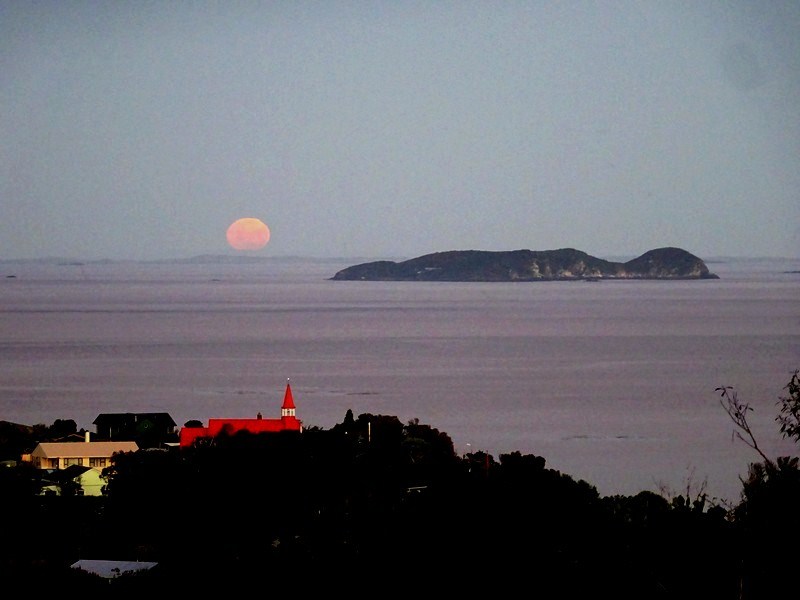
The end of the day at Oban


Horseshoe Bay, a neighbouring bay north of Halfmoon:


A local joke tells this should be the "halfmoon" bay, not the other, because of its perfect shape.


The Coast and the Bush

Stewart Island is situated in a region of unpredictable weather; 275 is the yearly average days of rain and frequently strong westerlies attacking the rugged granite, bush-clad island.


Wild beaches: Mason Bay


On the remote and wild west coast of the island lies Mason Bay, a desolately beautiful 14 km crescent of sandy beach.

The Dunes at Mason Bay.

The dunes here stretch inland as far as 3 km and are an amazing example the original dune ecosystem

The historic hut at Mason Bay is refurbished and more comfortable.


Lonnekers Beach


North Rakiura
The North Rakiura Track and huts.

The circular  Rakiura Track is Stewart Island's most famous hike. Taking three days, the trail covers 36 kilometers. It's a gentle track, convenient for all.


The circuit follows open coastline, along exposed shores of windswept trees and brush, crossing the forested interior of the island and winding along sheltered shores, inlets, bays and mudflat. In its mid section, the track crosses steep hills covered in dense forest, with well-maintained and gravelled trails.


Rakiura National Park covers 80% of the island's total area, over 200 km of tramping trails, forests of native trees and low-growing sub-alpine shrubs and grasses.

Port Williams Hut. There are several huts to accomodate hikers along the trail.

In fact, the inner bush feels much more remote than the twenty minute flight on a small plane or hour-long passage on the often ferry might suggest.

Maori Bay suspended bridge.

Rakiura Track
https://www.youtube.com/watch?v=MkjmbjH3zuo

The southernmost point in the island's central ridge is Mount Allen, at 2,460 feet. Sub-alpine habitat allows endemic flora to grow free; this rare buttercup is one of a number of plants found only on Stewart Island.

Mount Allen Buttercup (Ranunculus viridis).


Many other small islands lie around the coast. Notable among these are Ruapuke Island, in Foveaux Strait 20 miles northeast of Oban; Codfish Island, close to the northwest shore; and Big South Cape Island, off the southwestern tip.

Codfish Island, small but spectacular.

South Island saddleback (Philesturnus carunculatus), once almost extinct, has recovered to a population of about 700.


Sunset at Mason Bay...

and at Rakiura Bay.


And more: at Stewart Island, you can even watch auroras! Austral auroras, of course, pink or green like this one.

Southern lights at Halfmoon Bay.


Friday, 26 May 2017

Birsay Bay Tearooom, at 59º N - tea and cakes in sub-arctic Orkneys


No, don't worry, I'm not changing to gourmet blogging...


One would not expect a dedicated and exquisite tea-room in such a lonely place at the far north of main Orkney Island. Nobody finds it just by chance, or just passing by - it is a pilgrimage tearoom; in fact, people go there through inhospitable and desolate lands just for the warm delicacies and, well, archaeology.


Anyhow, it does deserves to be mentioned as Ultima Thule.


This is mainland Orkney, where the capital Kirkwall and Stromness, the magical town of adventurers, are situated, East and West of the island. You have to travel some 25 km northwardly to find Birsay Bay.

Tea with a view

Birsay Bay, northern tip of mainland Orkney.

Coordinates: 59°08′ N, 3°18′ W
- the latitude of Stavanger, Norway, or most of Hudson Bay, Canada.

Panoramic views overlooking the Brough of Birsay.

The coach corner for comfortable views.


Wilderness outside, and cold; coziness inside, warm and sweet....

Shortbread, cookies, biscuits...

Incredible home made cakes, they say.


Close around Birsay, some bits of History and architecture are worth a visit.

Earl's Palace ruins

The ruins of the Palace of Robert Stewart, Earl of Orkney, built in the late 16th century.


The St. Magnus Church


The present church building dates mostly from the eighteenth century. Located in the south wall is a bricked lancet window, the upper part of the thirteenth century.


The Brough of Birsay

This tidal island, run by Historic Scotland, holds an Iron Age hill fort, Norse ruins dating back from the 9th century to the 13th century, as well as evidence of the earlier Pictish settlement from the 7th century onwards. During low tide there is a two hours interval when access is possible by a slippery stoneway.

Around Birsay thee are several other prehistoric sites.


Already a taste of the Faroe Islands, they are not that far...


Sunday, 7 May 2017

Old Crow, an Arctic native village in Northern Yukon, Canada


This time we travel to the Beaufort Sea coast of Yukon, west of the McKenzie Delta, and then southwards inland. This is a Gwitch'in ethnic region, a native population living around the Porcupine River lowlands and mostly settled at the village of Old Crow.


Their name means "people of the lakes". Other smaller communities can be found at Fort Yukon, Fort McPherson and the NWT region's capital, Inuvik.


At the banks of Porcupine River, south of the Ivvavik and Vuntut Parks, Old Crow benefits from a pristine natural taiga surrounding.

Flatland taiga covers Porcupine River basin at northern Yukon.

Old Crow ('Teechik' in Gwich’in) is an inland community in Canada's Yukon Territory, in periglacial environment. The community is situated by the Porcupine River - tributary of the large Yukon River - in far north Yukon region. It's the only settlement there north of the Arctic Circle.


At over 67º North, Old Crow experiences a sub-arctic climate, which means long, cold winters, and a short but sunny summer.

The old mission cabin welcomes visitors, though amenities and accommodation are very limited.

Old Crow's main road, featuring the wide façade of the Community center.


Old Crow is the only Yukon community that cannot be reached by road.

Coordinates: 67° 34′ N, 139° 48′ W
       (~ 120 km north of the Arctic Circle)

Population: 250-300, Vuntut Gwitchin                                       First Nation


Harvesting caribou is essential to the livelihood and the traditions of the Gwich’in people. Their main sources of livelihood are trapping, hunting and fishing. The Porcupine Caribou provides meat and skin for boots, moccasins, mitts, traditional outfits, and even decorative housewares.

A local's log cabin typically decorated with caribou antlers.


The old Mission cabin, now b&b, from 1935.

Old Crow School


The Health Center and Nursing station.

The Old Crow Health Centre was built in 1960 and later upgraded in 1985. This large building houses a clinic, offices for staff, a visitor's suite, storage space. It is staffed year round by two Nurses.

Royal Canadian Mounted Police (RCMP) detachment.

The anglican church of St. Luke.


St. Luke’s Anglican Church was built in 1959 to replace the community’s original church. This log building echoes with memories from the past.

Renewable power station

A project of Solar Energy power has been implemented since 2014 by the local Vuntut government to decrease costs and reduce gas emissions.


Old Crow's thermal amplitude can be huge - a record of -61ºC in January to +36ºC in July. In winter, 12-14 days of full polar night happen in December, but over 3 months of midnight sun happen from May to August - that's when the Solar Energy system will be fully profitable.
What a climate show !

Old Crow's Community Center

The Community Center is where most things happen at Old Crow: traditional potlatches, dances, concerts, lectures, handcrafting, courses...

Inside the Community hall, photographs of community Elders, past and present, are hanging on the walls.

Gwich’in men are well known for their crafting of snowshoes, birchbark canoes, and the two-way sled. The women are renowned for their intricate and ornate beadwork. They also continue to make traditional caribou-skin clothing and porcupine quillwork embroidery.

Beading on slippers.


Hand made caribou skin boots.

Gwich'in embroidery, dog blanket.

Baby bag, porcupine embroidery


The only way to access the community is through the Old Crow airport.

"Air North" flights link Old Crow to Dawson City and Inuvik.


Ivvavik Park and the Porcupine River


Initially named "Northern Yukon National Park", Ivvavik Park was renamed in 1992. The park protects a portion of the calving grounds of the Porcupine Caribou herd and represents the Northern Yukon and Mackenzie Delta natural regions.

The Porcupine River (Ch’ôonjik in Gwich’in) is a 916-kilometre tributary of the Yukon River in Canada. It flows north through the community of Old Crow, crossing a taiga land covered by small and larger lakes.

Old Crow and the landing strip are visible up left, in one of the meanders of the Porcupine.

A landscape where plants and animals managed to survive in a land where Arctic and sub-Arctic meet.

Caribou crossing herd, Porcupine river.

Caribou hunter, Porcupine river.

The boreal taiga forest in the Parks and banks of the Porcupine is mostly above the arctic circle, as the tree line here is displaced to a higher latitude; spruces, birch, alder, larch and willow manage to survive in the cold. But the northern and coastal strip of Ivvavik Park is treeless arctic tundra.