Monday, 4 September 2023

Seyðisfjörður, pretty village in East Iceland


Seyðisfjörður or Seydisfjoerdur is a town and municipality in Iceland's Eastfjords region, at the innermost point of the fjord of the same name.


Connected to Scotland and the Faröe, this is a typical icelandic village, with a tiny port deep into the fjord, surrounded by mountains and wild waterfalls.


Settled at the sandy bottom of the fjord, it's almost unreally pretty in the unspoiled breathtaking landscape.


Seyðisfjörður

Coordinates: 65°15′ N, 14°0′ W, just one degree below the Arctic Circle.
Population:  ~ 670 inhabitants.


The town was settled by fishermen from Norway in 1848, on the lowlands of the fjord, where a few farms had existed for centuries. These settlers also built some of the present day wooden buildings.


Seyðisfjörður has a library, a hospital, a post office, some retail activity, a visual arts centre, a Technical Museum and still a local heritage museum, the only two cinemas in the east of Iceland, three small hotels, a swimming pool ! Not so tiny, so.

The Blue Church (Bláa Kirkjan) is the absolute central landmark.


Legend tells that the church, from the 13th century and dedicated to St. Mary, has been moved several times; it was surely moved into Seyðisfjörður in 1921, but after so many changes and a fire no one knows what remains from the original medieval church, maybe just some of the wooden walls.
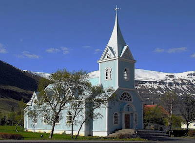

A praised concert season takes place each summer at the Blue Church.

https://www.facebook.com/blaakirkjan


As tourism is replacing the traditional fishing activity, hotels are growing in number.


This wooden house in blue is the old Pharmacy.

  The old Post Office is now a small Hotel.

19th century, Norwegian style.

Wooden house in red...the Music School.

The Norwegian-built houses are the real treasure here.

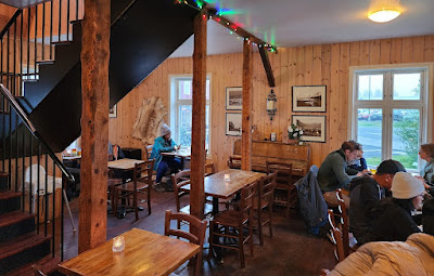
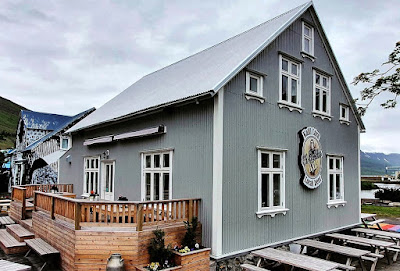
Kaffi Lara


The café in town 
- this is Kaffi Lara, at Norðurgata

 
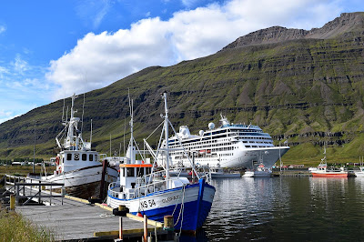
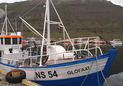
The small harbour is still active with a few fishing ships, but presently it is also dedicated to tourism and leisure.


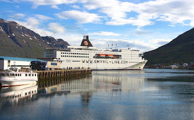
The Smyril Line MS Norröna keeps a daily link to Denmark and the Faroe Islands.

The Skaftfell Art Centre

Amazingly, the town also has an Arts Centre:
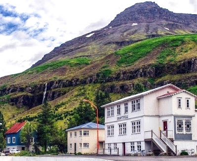

Skaftfell is a visual art centre to encourage the development of contemporary art. It is a meeting point for artists and locals and its activities are based on exhibitions and events, and also an international residency program.

 
The Centre is installed in a 1909 Norwegian house.

Some of Iceland´s best waterfalls are located in the vicinity of Seyðisfjörður.
 
This is Gufufoss, 19 m high
 
----------------------
The first telegraph cable connecting Iceland to Europe started in 1906 from Seyðisfjörður, built by
Great Nordic Telephone Company.
For several years this was a hub for international telecommunications.
---------------------- 


Friday, 31 March 2023

Tsiigehtchic (Arctic Red River), a native Gwich'in hamlet in the Canadian Arctic


This time we are in the Northwest Territories of the Canadian Arctic.

Tsiigehtchic (="mouth of the iron river") is a native village on the banks of the Mackenzie River, where it is joined by the tributary Arctic Red River. This is a strategic point on the Dempster Highway, the great northern highway to Inuvik; here the crossing of the river is still done by ferry.


The natives of this region are the Gwich'in people, belonging to the Athabascan family (Navajo, Apache), with a traditional hunter-gatherer lifestyle.

The first contact with the Gwich'in people was made by the British officer and explorer John Franklin in 1825. Over the next 150 years, traders, missionaries, prospectors and others followed; the village was founded in 1868 around a Catholic Mission; some years later, in 1902, Hudson Bay Co. also built an outpost there.


Tsiigehtchic (Arctic Red River) , NWT Canada

Coordinates: 67° 26′N, 133° 44′W
                   (165 km north of the Arctic Circle)

Population: ~170

Located at the confluence of the two rivers, perched high above the bank, Tsiigehtchic is also worth noting for its setting.

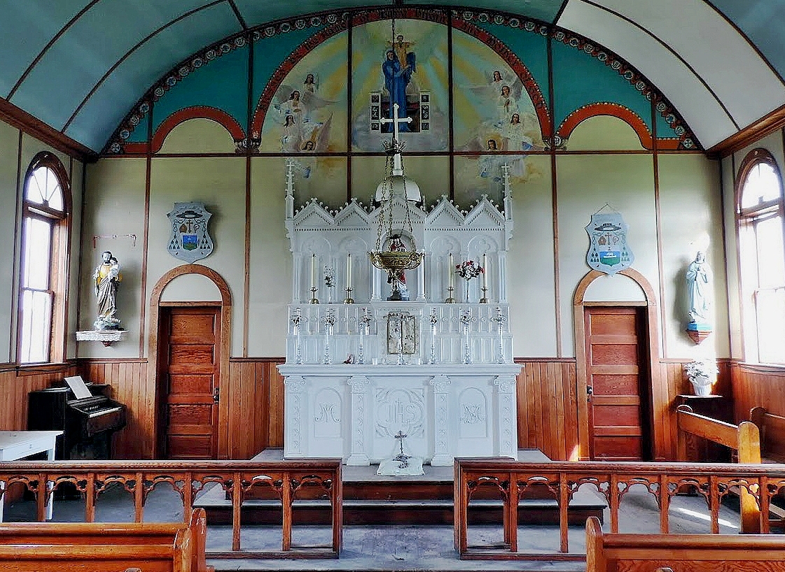
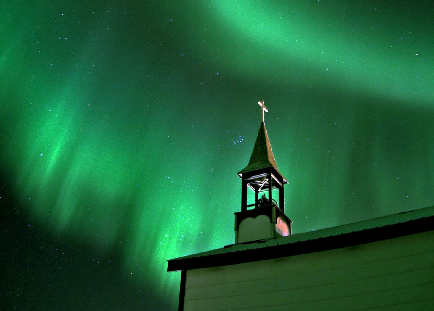
The Catholic Mission was made up of two churches from 1895-1896, facing each other. The present day buildings, a church and a chapel, are later buildings from the 1920's.


Some of the main buildings:

General view; the Community Office is the blue house (centre).

'Tsii' has a post office, a school, a sports hall, an administrative office and a grocery store. The small health center has an itinerant nurse who stays for a month in the winter.

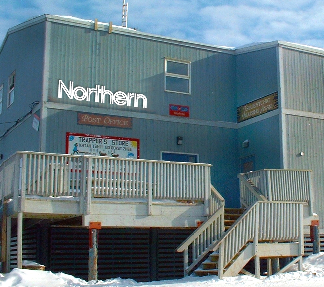
Local trade focuses on the Northern warehouse, a two storey buliding.

Trapper's Store and Post Office are installed at Northern building.

Children with popsicles they bought at Trapper's.

There are just over 170 inhabitants, who still follow a traditional way of life of hunting and fishing with traps. Many of them go away for long months, “out in the lands”, as they always have.

The Basic Health Unit.

Chief Paul Niditchie school

School students learning survival in the wilderness.

Gwich'in Community Administration.

In winter the rivers usually freeze and can be crossed by marked ice roads.


The Dempster Highway Ferry Crossing

The Dempster Highway is 740 km long on dirt road, between Dawson City and Inuvik, and reaches the Arctic Ocean after crossing the Yukon and the NWT, crossing the Polar Circle and offering unique scenery of open spaces and remote beauty. Split by the Mackenzie river, only a ferry crossing allows the connection. 

Its course runs on both the other river banks with a possible connection to Tsiigehtchic.

The Louis Cardinal ferry 


In winter the Mackenzie forms a solid frozen road to the Arctic Ocean. Inuvik, the terminus of the road, is then a two-hour drive away.

The road ends near Tuktoyaktuk, by the Arctic Ocean.


Monday, 13 February 2023

Oodaaq, island 83-42 and the flowers of Kaffeklubben


The island of Oodaaq, found in 1978, was little more than a gravel bank in the arctic ice, and was for some years considered the northernmost territory on the planet. It was located off the north coast of Greenland, and eventually disappeared in 1980, never to be seen again - these stony shingle banks are not permanent, they end up swallowed by floating ice, and then submerge in the ocean. Several other similar to Oodaaq have been sighted.

The first team to set foot on Oodaaq left a 'cairn', a pile of pebbles, and a message. It didn't last long. 
 
More than twenty years later, island 83-42 was discovered, a slightly larger rocky accumulation, by the American Dennis Schmitt in 2003.

Dennis Schmitt

In the lack of a better name, '83-42' ended up being assigned based on the island's latitude: 83º 42' 7.2'' N ; some also know it as 'Eklipse 0'. It has been visited since then, and as part of the boulders are covered with ice, it was possible to take measurements: 35 meters long by 15 wide and 4 meters above the sea. This height is not enough to guarantee the stability of the 'island' with currents and tides, but for the time being it still holds up. Some lichens found on the rocks may even indicate a longer lifespan. 

If it is considered an 'island', 83-42 will have the planetary record for northern latitude..

In its own way, it is a beautiful island.

Anyway, it is currently considered that the 'terra firma' further north on the planet is still the neighbouring Island of Kaffeklubben, 'Coffee Club Island' (!). Comparatively large, Kaffeklubben is also found off the northeast coast of Greenland. It was discovered by the great historic explorer Robert Peary in 1900, at 83° 40' N, is almost 1 km long and reaches 30 m in height. It may have existed for a few thousand years.

On the top of Kaffeklubben, a more substantial island.

After its discovery, it was first visited by the Danish explorer Lauge Koch in 1921, who gave it the jest name "coffee club" in honour of the cafeteria of the Museum of Mineralogy in Copenhagen. Despite the inhospitality of the island, there is flora in Kaffeklubben! Various mosses, liverworts, lichens, and flowering plants:

Arctic Poppy (papaver radicatum) growing from mud between pebbles.

Saxifraga oppositifolia


They grow in an minuscule islet in the middle of the ice, above 80º N, under maximum temperatures of zero (Celsius). A true miracle: flowers in the most extreme North of the Earth.

More:

---------------------------------------

It is rather amusing to understand who owns these islands. To start,  all of Greenland belongs geologically to North America; but also Greenland is  a large colony of Denmark, which for that reason is one of the remaining colonial empires. From a political-administrative point of view, therefore, the islands are an Overseas Territory of the European Union, although the currency used there would be the Danish krone ! I'd like 83-42 to be a no-owner, no man´s land.